
Wentzville Neighbors by Block Source
Public information around a Wentzville address is fragmented by purpose. County GIS can place adjacent parcels and identify parcel IDs. City GIS adds civic layers, such as road ownership, ward, school, fire, water, zoning, and special-taxing boundaries. Recorded plats and indentures describe legal subdivision arrangements. The City Clerk can supply a trustee-contact lead. None of these sources is a public roster of people who live on a block, and a parcel owner should not be called an occupant without separate dated support.
| Source | What It Shows About a Block | Access |
|---|---|---|
| St. Charles County GIS | Adjacent parcels, parcel IDs, and county map layers | Public web map, used as location context |
| Wentzville GIS | Zoning, road owner, wards, school, fire, water, and taxing layers | City interactive map; exact live controls were not located |
| Voter statute and lookup | Specified identity, address, and election-geography fields where lawfully available | Missouri portal and RSMo §115.157; protected addresses excluded |
| Recorder plats and indentures | Subdivision boundaries, easements, common ground, assessments, and restrictions | Recorded land records; index or image fees can apply |
| City Clerk trustee database | Subdivision trustee or association contact lead | City Clerk request or office; member list not located |
| Community Council of St. Charles County | Umbrella community-resource connection | Organization route; membership-directory details not located |
The distinction between a boundary and a household matters. A GIS result can show touching parcels, while a Recorder instrument can show a recorded property interest. A voter record, if a lawful route returns one, has its own statutory limits. Each item answers a narrow question at a particular time. It cannot establish that every parcel has a voter, that a named owner is present, or that a map label identifies all Wentzville neighbors.
Map Wentzville Adjacent Parcels
The adjacent-parcel method begins with an exact address or parcel, then moves outward only through the polygons that touch the selected parcel. The St. Charles County Public Web Map and the city map index provide the geography for that first step. City documentation describes address or parcel search, view, measure, and print functions. The research did not establish a buffer command, an exact click-to-owner sequence, or every value exposed after a parcel selection, so those features should not be assumed.
- Search the address or parcel and record the selected parcel ID, map date, and visible layer.
- Zoom to the parcel and pan to the polygons that share a boundary or corner, distinguishing a map adjacency from a legal relationship.
- Carry each adjacent parcel ID to the Assessor or Recorder only for the defined question being tested.
- Use the legal description, plat, or recorded indenture to test a claimed subdivision connection.
- For a full street-by-street address trail, use the Wentzville Streets reference instead of extending a block review into a household list.
Parcel geometry is valuable because the identifier can bridge the Assessor, GIS, and Recorder systems. It is not a legal survey or title opinion. If a property was split, readdressed, or appears beside common ground, compare the identifier, legal description, and recorded plat before deciding what the relationship is. This protects a Wentzville neighbors search from confusing a visual map pattern with a documented boundary.
Note: Retain the map layer and access date, because civic boundaries and parcel displays can change independently of a mailing address.
Compare Wentzville Civic Layers
Wentzville’s official maps are useful precisely because they do not collapse different geographies into one answer. The city map materials identify corporate limits, road ownership, wards, Wentzville R-IV, the Wentzville Fire Protection District, water-service layers, planning boundaries, zoning, flood or storm layers, special-taxing districts, subdivisions, and pipelines. A city address can sit near a county parcel or planning boundary, while a postal label can serve a broader delivery area. Each layer should remain labeled with its source and purpose.
Road ownership is a practical example. The city map distinguishes city, county, MoDOT, and private road context. That can explain why a records request or maintenance question belongs with a different agency, without implying a change in property ownership or who lives nearby. The same caution applies to school, fire, water, ward, and taxing layers. These are civic context for Wentzville neighbors, not membership lists or identity records.
Read Wentzville Subdivision Indentures
Wentzville’s HOA and Subdivision Resource Guide states that subdivision indentures are recorded with the Recorder at the same time as the plat. The guide names trustees, duration, rights, maintenance, assessments, liens, restrictions, architectural control, amendments, and bylaws as common terms. Those records help define a formal subdivision arrangement. They do not provide a public member roster, and city government does not enforce private indentures.
The Guide also warns that common ground may sit beside undeveloped property outside the subdivision. That makes an important Wentzville neighbors distinction: an adjacent map polygon may not belong to the association. Check the recorded plat and indenture alongside the GIS display. A sign, a street name, or a nearby green space is not enough to establish the legal association boundary. A recorded assessment lien can be an instrument lead, not a statement about a household.
Note: Use a recorded plat or indenture to define a subdivision, because map proximity alone cannot confirm the association relationship.
Use Wentzville Trustee Contact Routes
Association research should begin with the office or record that actually maintains the contact lead. The City Clerk’s subdivision trustee database is such a lead. It is not a directory of households. Recorded indentures and plats are held through the Recorder’s land-record path, while the Community Council offers a local organization route. The contact table keeps these roles distinct and avoids treating a civic or association contact as a resident list.
| Route | Block Question It Can Answer | Contact or Access |
|---|---|---|
| Wentzville City Clerk trustee database | Where to seek a subdivision trustee or association contact lead | 1001 Schroeder Creek Blvd, Wentzville, MO 63385; 636-639-2012; Monday-Friday 8-5 |
| St. Charles County Recorder | Whether a plat, indenture, easement, or other instrument is recorded | 201 N Second Street, Suite 338, St. Charles, MO 63301; land-record phone 636-949-7507 |
| Community Council of St. Charles County | Community-resource connection, not a membership list | Organization website; membership-directory details not located |
A focused request names the subdivision, record series, and relevant period. Missouri Sunshine Law provides a route to ask for existing public records, but a custodian is not required to create a new neighbor list. Ask for segregated releasable portions if a record includes protected material. That keeps the request tied to a defined civic or property question.
Find Wentzville Community Connections
The Community Council of St. Charles County is a documented umbrella community-resource connection. It can be a useful organizational starting point after the address, parcel, and association record are understood. Research did not locate a public member directory, block-watch roster, congregation roster, or citywide association-member directory. Those gaps are important limits, not data to rebuild from unrelated records.
The resource is best used for community context and verified connection paths. It cannot verify who occupies a nearby home. When an association boundary matters, return to the Recorder’s indenture and plat, then compare those records with the county and city map layers. That sequence remains more reliable than making a Wentzville neighbors claim from an organizational listing alone.
Compare Wentzville Neighbor Sources
Official record systems and commercial neighbor-lookup categories answer different questions. Official sources identify their custodian, record type, access route, and limitations. Commercial categories may combine public filings, addresses, and inferred associations from several places. Their accuracy, update timing, identity matching, and lawful-use limits vary. A block search is stronger when every conclusion is tied to the source that actually supports it.
| Source Category | Best Use | Key Limit |
|---|---|---|
| County or city GIS | Locate parcels and civic map context | Map context is not a legal survey or household roster |
| Recorder and recorded plats | Test legal descriptions, transfers, indentures, and boundaries | A recorded name or interest does not prove occupancy |
| City Clerk trustee route | Seek an association or trustee contact lead | No member directory was located |
| Commercial neighbor-lookup category | General leads that require independent verification | May combine stale, mismatched, or inferred information |
Use a map result as a question, then verify it with the proper custodian. The public sources are traceable and have clear boundaries, including the difference between a parcel owner, an association trustee, and a historic occupant. That role-based approach helps avoid an unsupported Wentzville neighbors conclusion.
Protect Wentzville Property Records
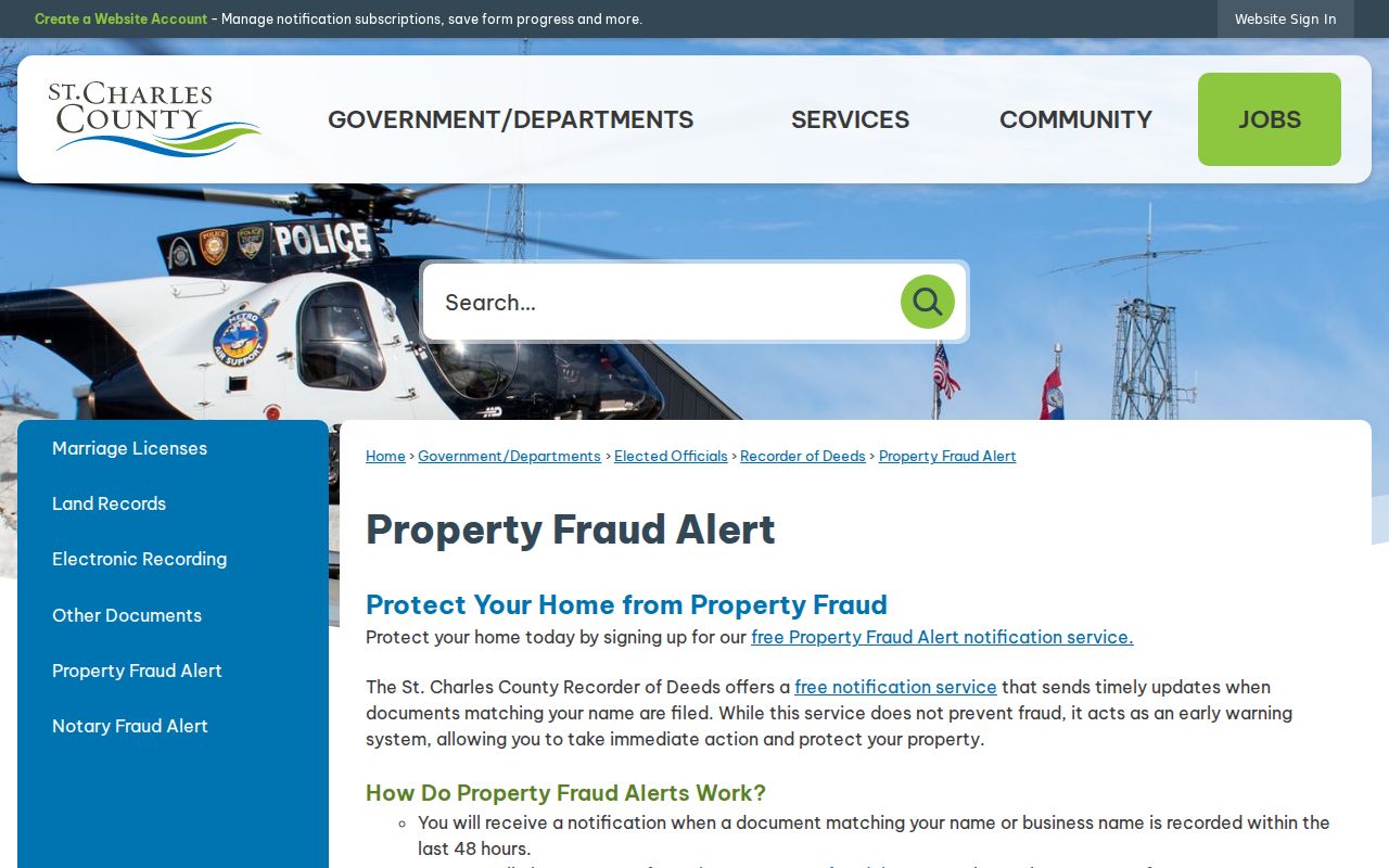
The county’s free Property Fraud Alert monitors a name or business name and sends an alert within approximately 48 hours. An alert is a prompt to examine a recorded instrument, not a finding that fraud occurred. The county says the Recorder cannot verify authenticity or remove an instrument without a court order. For the Recorder’s alert questions, the county lists 636-949-7505.
The alert route is a sensible property-owner safety tool when a block review reaches a recorded document. June 2025 county reporting noted new signups and alerts while emphasizing that an alert is not necessarily fraud. Verify a suspicious deed, court notice, or voter message through the issuing custodian or the county’s published contact route. Do not use an alert to label a neighbor or expose a person’s information.
Note: Keep the instrument number and issuing office with a suspicious record, then verify it directly before acting on the alert.
Protect Wentzville Neighbor Privacy
Wentzville neighbors research must respect the records that are not public. Missouri Safe at Home provides a substitute address for eligible participants, and protected voter addresses can be closed under the statutory process. Utility accounts, private delivery data, protected residential information, restricted vital records, and sealed court material do not become public because they would be convenient for a block search. A failed official search is also not proof that someone is absent.
For a genuine discrepancy, ask the responsible custodian about a correction, a closed-record rule, or the existing record series. A narrow request protects the people involved and produces a better answer. The surrounding block is best understood through documented parcel, boundary, and association roles, not by turning public fragments into a personal dossier.